
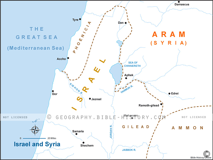
The map of Israel and Syria during biblical times is a fascinating glimpse into the ancient geography and historical context of this region. In this era, which spans from roughly 1200 BCE to the 1st century CE, the landscape was vastly different from what we see today. Here is a description of this historical map:
Geography:
The map of biblical Israel and Syria depicts a rugged and diverse terrain. To the west lies the Mediterranean Sea, providing a vital trade route and access to the coastal cities such as Joppa and Tyre. To the east, the land gradually rises into the rugged hills and mountains of modern-day Lebanon and the Golan Heights. These highlands were dotted with ancient cities and fortresses like Jerusalem, Samaria, and Hazor.
Prominent Bodies of Water:
- The Jordan River: Running south from the Sea of Galilee to the Dead Sea, the Jordan River was a critical water source and played a significant role in many biblical narratives, including the crossing of the Israelites into the Promised Land.
- The Sea of Galilee (Kinneret): Located in the north, this freshwater lake was a vital source of sustenance and is prominently featured in several biblical stories, including many involving Jesus and his disciples.
- The Dead Sea: To the south, the Dead Sea is the lowest point on Earth's surface. It is known for its extreme salinity, making it inhospitable to most life. The cities of Sodom and Gomorrah, mentioned in the Bible, were said to have been located near its shores.
Kingdoms and Territories:
The map displays various kingdoms and territories that existed during biblical times, including:
- The Kingdom of Israel: In the north, with its capital in Samaria, this kingdom was often at odds with its southern counterpart, Judah. Prominent biblical figures like King Ahab and the prophet Elijah lived here.
- The Kingdom of Judah: In the southern part of the map, with its capital in Jerusalem, Judah was the center of religious life and featured prominently in the stories of King David and King Solomon.
- Various Canaanite and Philistine City-States: Along the coastal plain and in the valleys, you can find cities like Tyre, Sidon, and Gaza, which were inhabited by various Canaanite and Philistine peoples.
Trade Routes:
Several trade routes crisscrossed the region, connecting it to neighboring lands such as Egypt to the southwest and Mesopotamia to the northeast. These trade routes facilitated the exchange of goods, cultures, and ideas.
Religious and Historical Significance:
The map of Israel and Syria is not just a geographical representation but a canvas of historical and religious significance. It was in this region that the stories of the Old and New Testaments unfolded, shaping the foundations of Judaism, Christianity, and, to some extent, Islam. Iconic sites like the Temple in Jerusalem, the Mount of Olives, and the tomb of Jesus in Jerusalem are all marked on this map.
Overall, this historical map provides a window into the ancient world, where the destinies of nations, the lives of prophets and kings, and the roots of three major world religions were intricately intertwined amid the diverse and challenging landscape of Israel and Syria.
Blank Topo Map of The World
Abraham’s Journey
The Captivity of Judah (586-516 B.C.)
The Fall of Judah 586 B.C.
The Northern Kingdom of Israel
The Southern Kingdom of Judah
The Divided Kingdom
The Fertile Crescent
Ur of the Chaldees
Shechem in Old Testament Times
Prophets, Kings, and Nations
Jesus Last Passover
New Testament Israel
New Testament Places
Old Testament Israel
Provinces of the Roman Empire
Israel during David’s Kingdom
David’s Kingdom
Cities of the New Testament 4
Cities of the New Testament 3
Cities of the New Testament 2
Mediterranean Sea
Cities of the New Testament
First Century Jerusalem
Empire of David and Solomon
David’s Kingdom
Israel Under Rehoboam
Ophir and Tarshish
The Period of the Kings
Ramoth Gilead
Samaria
Solomon’s Temple
Zarephath and MT Carmel
Jabesh Gilead and Tribes
Judah in the Time of David
Kingdom of Saul
Kirjath Jearim
Michmash
Mount Gilboa in the Time of David
Nob Davids Flight
Shiloh
Israel and Judah
Assyrian Empire Under Esarhaddon
Assyrian Empire Under Sennacherib
Captivity of 10 Tribes
Events in 2 Kings
The Khabur River
Israel and Syria
Captives From Judah
Kingdom of Jeroboam
Mesha’s Kingdom
Pharaoh Necho Battles King Josiah at Megiddo
Babylonian, Mede and Persian Empires
Samaria and Nearby Territories
Syria at its Height
Hebron
Mahanaim
1949 Map of Israel With Boundaries
First & Second Journeys of Paul
Journeys of the Apostles
Paul’s Third Missionary Journey
Saul’s Journey to Damascus and Arabia
Paul’s Final Visits
Paul’s 1st Missionary Journey
Paul’s 2nd Missionary Journey
Paul’s 3rd Missionary Journey
Paul’s Voyage to Rome
Phillip Journeys to Samaria and Gaza
Judah at the Time of Amos
Empire of Alexander the Great
Israel Under the Maccabees
Galilee During Maccabees
Idumea Intertestamental Period
Kingdom of the Ptolemies
Kingdom of the Seleucids
Ptolemaic Egypt Seleucid Asia
The Roman World
Kingdom of Ptolemies and Seleucids
The World During the 6TH Century BC
Mount Horeb
The Red Sea
The Exodus
Ezra’s Journey to Restore Jerusalem
Israel and Judah During Hosea’s Time
The Ancient World
Canaan During the Time of Abraham
The City of Shechem
Supposed Location of the Garden of Eden
The Land of Israel in Genesis
The Jordan River
The Kingdom of Nimrod
Mount Ararat and Mesopotamia
The Descendants
Sodom and Gomorrah
The Kingdom of Egypt
The Hamites
The Kingdom of the Hittites
Ur of the Chaldees
Judah at the Time of Haggai
Jesus Passes Through Samaria