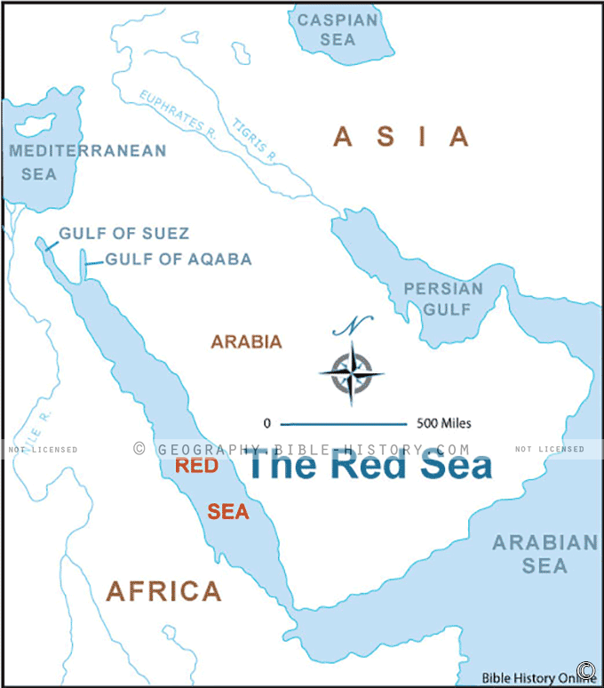

The Map of the Red Sea is a captivating visual representation that transports you to one of the most dramatic and miraculous events recorded in the Bible. This meticulously designed map brings to life the iconic episode of the parting of the Red Sea, a moment of divine intervention and liberation for the Israelites.
As you explore this map, you'll be immersed in the geographical context of the Red Sea, with a focus on the specific region where the miraculous event is believed to have occurred. The map details the ancient coastal landmarks, the probable routes taken by the Israelites, and the strategic location where they are thought to have crossed the sea on dry land.
Beyond the geographical information, this map provides an immersive experience by offering annotations, illustrations, and landmarks related to the biblical narrative. You'll find depictions of the Israelites' exodus from Egypt, the awe-inspiring parting of the waters, and the pursuit of Pharaoh's army, all of which are central elements of the Exodus story.
The Map of the Red Sea serves as a valuable educational tool for scholars, theologians, historians, and individuals interested in the biblical account. It allows you to gain a deeper understanding of the cultural and religious significance of this pivotal event in Judaism and Christianity, as well as its enduring impact on the human imagination.
Whether you approach it from a faith perspective or as a study of history and culture, this map invites you to step into the biblical narrative, witness the divine intervention at the Red Sea, and appreciate the profound symbolism and meaning embedded in this remarkable story.
Embark on a journey of faith, wonder, and historical significance with the Map of the Red Sea, and gain a deeper appreciation for the enduring legacy of the miraculous parting of the waters that has captured hearts and minds for generations.
Blank Topo Map of The World
Abraham’s Journey
The Captivity of Judah (586-516 B.C.)
The Fall of Judah 586 B.C.
The Northern Kingdom of Israel
The Southern Kingdom of Judah
The Divided Kingdom
The Fertile Crescent
Ur of the Chaldees
Shechem in Old Testament Times
Prophets, Kings, and Nations
Jesus Last Passover
New Testament Israel
New Testament Places
Old Testament Israel
Provinces of the Roman Empire
Israel during David’s Kingdom
David’s Kingdom
Cities of the New Testament 4
Cities of the New Testament 3
Cities of the New Testament 2
Mediterranean Sea
Cities of the New Testament
First Century Jerusalem
Empire of David and Solomon
David’s Kingdom
Israel Under Rehoboam
Ophir and Tarshish
The Period of the Kings
Ramoth Gilead
Samaria
Solomon’s Temple
Zarephath and MT Carmel
Jabesh Gilead and Tribes
Judah in the Time of David
Kingdom of Saul
Kirjath Jearim
Michmash
Mount Gilboa in the Time of David
Nob Davids Flight
Shiloh
Israel and Judah
Assyrian Empire Under Esarhaddon
Assyrian Empire Under Sennacherib
Captivity of 10 Tribes
Events in 2 Kings
The Khabur River
Israel and Syria
Captives From Judah
Kingdom of Jeroboam
Mesha’s Kingdom
Pharaoh Necho Battles King Josiah at Megiddo
Babylonian, Mede and Persian Empires
Samaria and Nearby Territories
Syria at its Height
Hebron
Mahanaim
1949 Map of Israel With Boundaries
First & Second Journeys of Paul
Journeys of the Apostles
Paul’s Third Missionary Journey
Saul’s Journey to Damascus and Arabia
Paul’s Final Visits
Paul’s 1st Missionary Journey
Paul’s 2nd Missionary Journey
Paul’s 3rd Missionary Journey
Paul’s Voyage to Rome
Phillip Journeys to Samaria and Gaza
Judah at the Time of Amos
Empire of Alexander the Great
Israel Under the Maccabees
Galilee During Maccabees
Idumea Intertestamental Period
Kingdom of the Ptolemies
Kingdom of the Seleucids
Ptolemaic Egypt Seleucid Asia
The Roman World
Kingdom of Ptolemies and Seleucids
The World During the 6TH Century BC
Mount Horeb
The Red Sea
The Exodus
Ezra’s Journey to Restore Jerusalem
Israel and Judah During Hosea’s Time
The Ancient World
Canaan During the Time of Abraham
The City of Shechem
Supposed Location of the Garden of Eden
The Land of Israel in Genesis
The Jordan River
The Kingdom of Nimrod
Mount Ararat and Mesopotamia
The Descendants
Sodom and Gomorrah
The Kingdom of Egypt
The Hamites
The Kingdom of the Hittites
Ur of the Chaldees
Judah at the Time of Haggai
Jesus Passes Through Samaria